Siteline is the top reality capture solution for San Francisco Bay Area and Portland companies. Our mission is to help project teams plan, design, and construct based on dimensionally accurate and reliable site conditions as early as possible.
Our Services
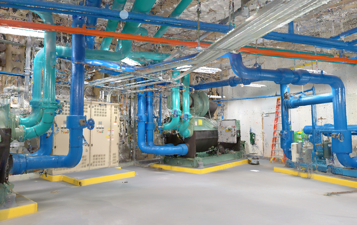
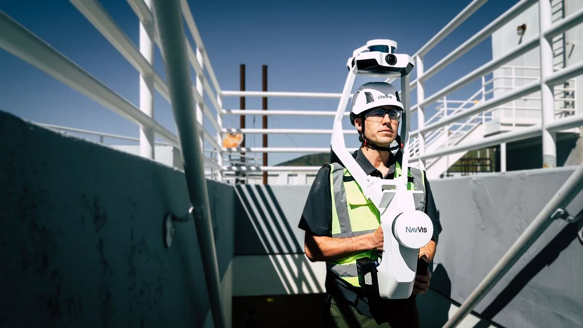
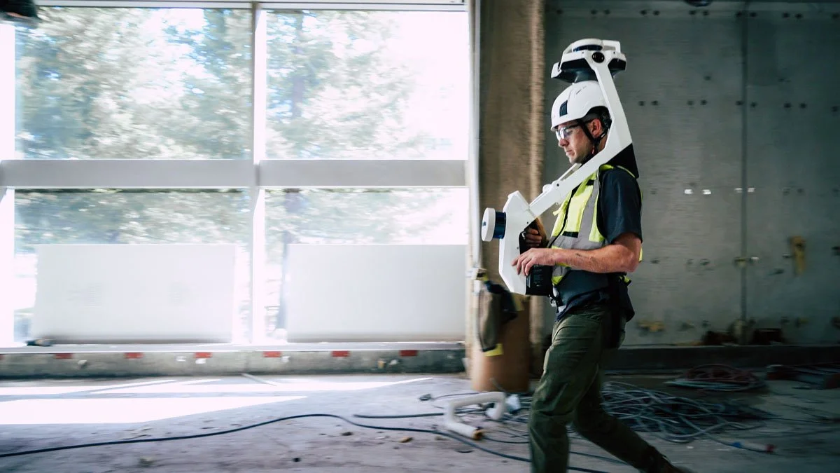
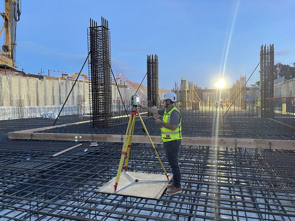
Our team of experts is well versed in using the latest lidar technology to capture everything you need on your project, including above ceilings. We are used to dealing with the complexities of active jobsite and occupied spaces and will work with your team to schedule, execute, and deliver the information you need to make your project a success.
Laser Scanning
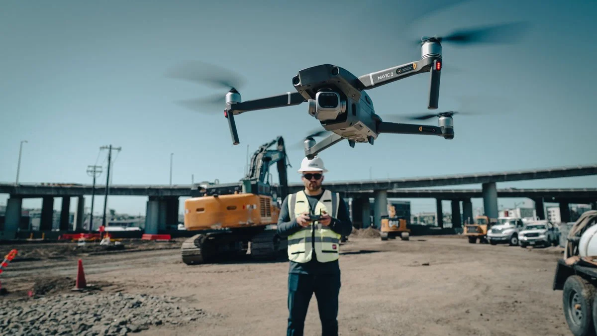
Siteline’s team of licensed drone pilots is ready to fly your project and provide you with deliverables you need. We provide a turnkey solution by handling preflight planning, FAA authorizations, flight operations, and postflight deliverable production. Flight deliverables include, aerial maps, customized videos, backgrounds for architectural renderings, volumetric analysis and timelapses.
360 Virtual Jobsite
Unable to find time in your busy schedule for a jobwalk? Let us bring help by bringing the jobsite to you via 360 imagery and video. Our team can capture using your system of choice and provide you with information you need in the platform you prefer. This service is often provided in conjunction with laser scanning.
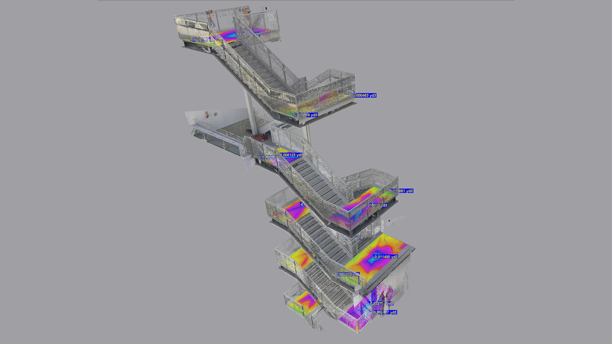
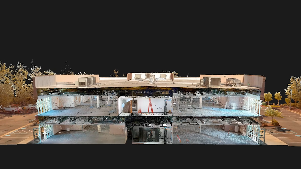
Scan to BIM
If you are looking to convert a point cloud into a 3D Revit model, our team has you covered. Whether it is generating a model from scratch or updating an existing one, we will provide you with a reliable model of the captured field conditions. Our modeling team is capable of modeling all disciplines and can model based on your custom BIM protocols.
Drone Capture